Poverty and Class Trends
Sprawl should be looked at as a type of land use pattern, which is directly intertwined with economic segregation (69). The act of sprawl “puts a greater degree of separation between income class” (69) and leads to greater inequalities. The city of Boulder has systemically reduced the possibly of this detrimental land use through Boulder County’s long history of land conservation programs. They have seemingly reduced the spatial mismatch because the dense urban fabric has been preserved- the lands with conservation easements limit the reaches of development.
Putting A Halt to Expansion The map called "Urban Land by Census Tract" illustrates that the vast amount of the city’s urban land was developed before 1970, and the boundary has not seen much growth since then. However, areas to the east of the city lines have experienced later development but most have encountered job decline from 2003-2008 (74).
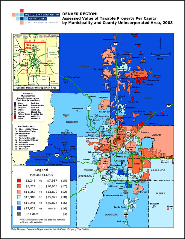
These places with more-recent growth also have on average higher taxes, which would discourage businesses in Boulder to relocate to those outskirt areas (Refer to the map below). There is little possibility for the abandonment of the city for suburban development because Boulder continues to thrive and thus, the lower-skilled workforce is not inherently isolated. The spatial pattern lends itself to employment density, which “nurtures economic dynamism and productivity” (63). This means that sprawling development and its effects are very unlikely.
Impoverished In Boulder However, Boulder does have a significant presence the population experiencing poverty. The 2010 U.S. Census Bureau estimated that 17,768 people or 20.1 percent of the city’s population was in poverty in the past year. Of that population, 14,137 were identified as white alone. Notably, the median household income 2013 estimate was $ 57,428. Kingsley 2003 used Denver as an example and stated that it was a predominately white metropolitan, with already relatively low concentration of poverty and experienced a significantly decrease in the 1900s from 14 to 7 percent, similar to Boudler, and dissimilar to the rest of the United States.
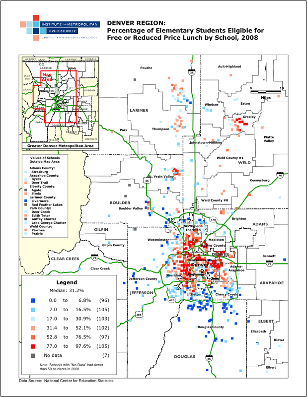
Boulder has identifiable class shifts. The city most likely has higher concentrations of households in poverty in certain tracts, which are unhealthier than the rest of the city. This is indicated in the map to the right (of Denver but Boulder is represented as well), which shows that Boulder has a varied presence of those receiving free lunch by school.
Keeping The Rich In the City Boulder is better off than some cities because they have growth control measures (conservation lands) and are able to maintain density and a healthy tax base. They are able to invest in city services, which all classes have access to through an extensive transportation network and maintained urban network. The city has apparently avoided the high costs associated with sprawl and unintentionally modeled aspects of Baron Haussmann’s renewal by keeping the rich within the center. The wealthy locating within the city center benefits all urbanites.
|
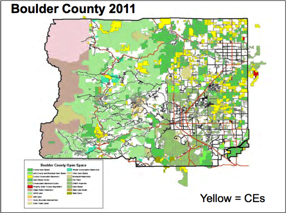
70. The map shows the conservation easements and preserved lands that surrounds the city of Boulder.

74
74
74
75
|
| Boulder, Colorado |
|
